The Pacific Crest Trail, the classic map by Erwin Raisz
The Pacific Crest Trail (PCT), the second longest trail in the US, is 2,650 miles long and stretches from Mexico to Canada through California, Oregon, and Washington. This map (copyrighted by Erwin Raisz) was georeferenced in QGIS (2.18.19) with GDAL Georeferencer.
Breweries in North America and Hawaii
Hexbin Map showing the number of breweries in North America and Hawaii. Brewery data was downloaded from The POI Factory; Country and State data was downloaded from Natural Earth Produced with QGIS 2.18.19 The POI Factory. Natural Earth.
2019 Iditarod
From Anchorage, in south central Alaska, to Nome on the western Bering Sea coast. The Iditarod race covers 1000 miles of mountain ranges, frozen river, dense forest, and desolate tundra in temperatures far below zero, winds causing low visibility, and long hours of darkness. Data were acquired from Natural Earth, the Bureau of Land Management, the U.S. Environmental Protection Agency, and the North American River Width Data Set (NARWidth). Created on QGIS 3.0 and CARTO.
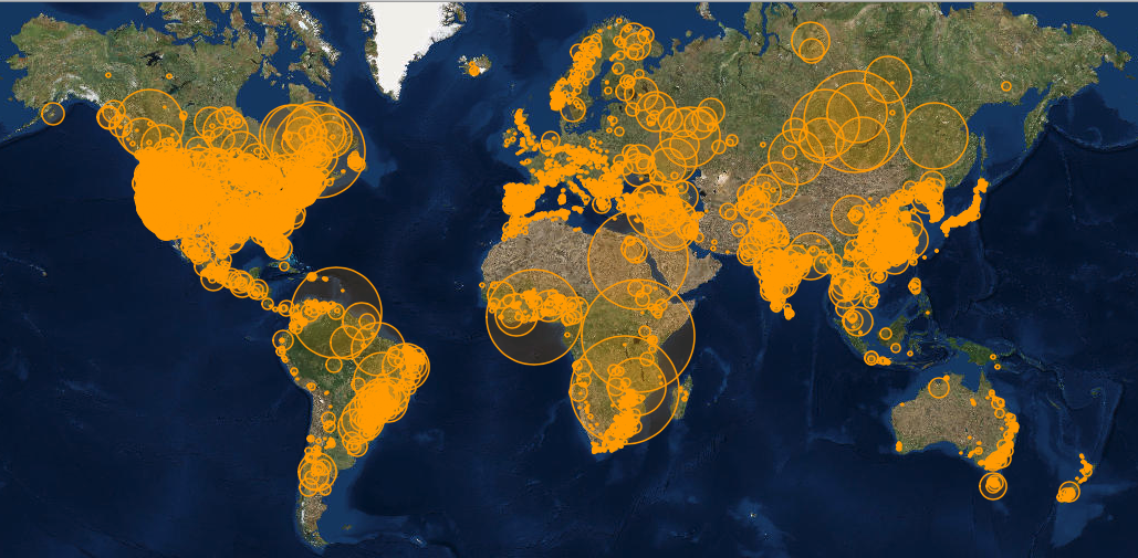
Reservoirs and Associated Dams of the World
This map created with leaflet shows reservoirs and their associated dams throughout the world. The size of the circles represents the representative capacity (cubic km) of each reservoir. The Global Reservoir and Dam Database, contains 6,862 records of reservoirs and their associated dams with a cumulative storage capacity of 6,197 cubic km. Data were aquired from NASA Socioeconomic Data and Applications Center (SEDAC). The map was generated using custom Javascript, including the Leaflet library.